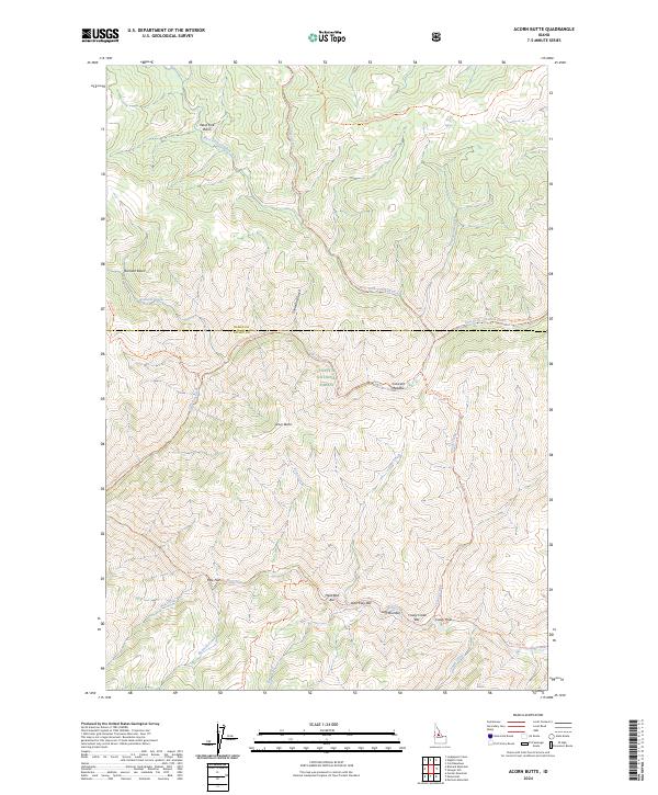
2024 Map of Acorn Butte
USGS Topo · Published 2024About this map
Acorn Butte stands as a central landmark in this high-altitude landscape where the Idaho and Valley County line bisects a heavily-forested wilderness. The terrain is defined by the sharp descent into the Crooked Creek and Big Creek drainages, which fall within the protected bounds of the Payette National Forest and the Frank Church-River of No Return Wilderness. A cluster of whimsically-named bars along the water—Hard Boil Bar, Over Easy Bar, and Soft Boil Bar—suggests a history of localized activity along these remote riverbanks. Travel through this vertical geography is restricted to established paths like the Silver Creek Trl and Gold-Meadows Trl, connecting landmarks such as Bismark Basin and Crescent Meadow in a region where the natural topography remains the primary architect of human movement.
Find a feature on this map
40 named features on this map. Tap any name to fly to it.
Don’t see what you’re looking for? This feature index may not catch every label — zoom into the map to look around manually.
Map Details
Editions of this 2024 Acorn Butte Map
This is the sole edition of this map. No revisions or reprints were ever made.
Other maps of this area

1956 · Elk City
USGS Topo · 1:250,000

1960 · Elk City
USGS Topo · 1:250,000

1962 · Mormon Mtn
USGS Topo · 1:24,000

1962 · Vinegar Hill
USGS Topo · 1:24,000

1973 · Center Mtn
USGS Topo · 1:24,000

1973 · Acorn Butte
USGS Topo · 1:24,000

1973 · Bismark Mtn
USGS Topo · 1:24,000
1973 · Monument
USGS Topo · 1:24,000

1978 · Wapiti Creek
USGS Topo · 1:24,000
1978 · Lodgepole Creek
USGS Topo · 1:24,000