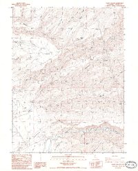
1985 Map of Acorn Hollow
USGS Topo · Published 1985About this map
Deer Creek meanders across the southern portion of this mid-1980s survey, anchoring a landscape marked by deep canyons and seasonal drainage. The area is defined by a series of prominent ridges, including Allen Ridge, Willow Tree Ridge, and Red Ridge, which separate various branches of Dye Creek and Mill Creek. This terrain necessitated a network of four-wheel-drive trails to reach isolated locations such as The Narrows and Morris Flat.
Find a feature on this map
43 named features on this map. Tap any name to fly to it.
Don’t see what you’re looking for? This feature index may not catch every label — zoom into the map to look around manually.
Map Details
Editions of this 1985 Acorn Hollow Map
2 editions found
Other maps of this area

1886 · Lassen Peak
USGS Topo · 1:250,000

1890 · Red Bluff
USGS Topo · 1:250,000

1891 · Chico
USGS Topo · 1:125,000

1892 · Lassen Peak
USGS Topo · 1:250,000

1893 · Chico
USGS Topo · 1:125,000

1894 · Lassen Peak
USGS Topo · 1:250,000

1894 · Red Bluff
USGS Topo · 1:250,000

1895 · Chico
USGS Topo · 1:125,000

1904 · Vina
USGS Topo · 1:62,500

1905 · Tehama
USGS Topo · 1:62,500