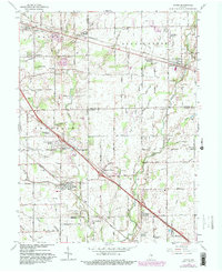
1962 Map of Acton
USGS Topo · Published 1982About this map
Acton and New Palestine anchor this landscape of transitioning farmland and growing residential developments at the intersection of Marion, Shelby, and Hancock counties. The Baltimore and Ohio Railroad cuts through the northern half of the sheet, connecting early rail stops like Julietta and Palestine with the surrounding countryside. This 1962 revision highlights the emergence of mid-century suburban pockets such as Charlemac Village, Charle Sumac Estates, and Indian Creek Estates, which began to fill in the spaces between older rural landmarks like the County Home and Township Sch. Numerous small family and community burial grounds, including Schildmeier and Freeman cemeteries, are scattered across the terrain, preserving the names of the area's nineteenth-century settlers. The drainage patterns of Buck Creek and Sugar Creek dictate the local geography, providing a baseline for the grid of country lanes like McGregor Road and Maze Road.
Find a feature on this map
75 named features on this map. Tap any name to fly to it.
Don’t see what you’re looking for? This feature index may not catch every label — zoom into the map to look around manually.
Map Details
Editions of this 1962 Acton Map
4 editions found
Other maps of this area

1948 · Indianapolis East
USGS Topo · 1:24,000

1948 · Beech Grove
USGS Topo · 1:24,000

1952 · Cumberland
USGS Topo · 1:24,000

1952 · Greenfield
USGS Topo · 1:24,000

1952 · Fountaintown
USGS Topo · 1:24,000

1953 · Greenwood
USGS Topo · 1:24,000

1953 · Shelbyville
USGS Topo · 1:24,000

1953 · Acton
USGS Topo · 1:24,000

1953 · Boggstown
USGS Topo · 1:24,000

1953 · Cincinnati
USGS Topo · 1:250,000