
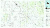
1965 Map of Acuff
USGS Topo · Published 1966About this map
The settlement of Acuff and the surrounding agricultural lands of the High Plains are captured here during a period of steady groundwater and petroleum extraction. Located near the Lubbock Co Crosby Co line, the landscape is defined by a dense grid of section-line roads such as Procter Road and Mimms Road, interspersed with numerous wells and the Ha-Na Field. Small communities like Midway and Robertson serve as local hubs for the farming and ranching families whose presence is suggested by the network of named thoroughfares like Winniford Road and Thomas Road. Several Landing Strips and a Quarry indicate the area's diverse industrial activity, from aviation to resource extraction, while the fine red dashed lines throughout the quadrangle denote established fence lines, providing a detailed record of 1960s land use and property divisions.
Find a feature on this map
26 named features on this map. Tap any name to fly to it.
Don’t see what you’re looking for? This feature index may not catch every label — zoom into the map to look around manually.
Map Details
Editions of this 1965 Acuff Map
This is the sole edition of this map. No revisions or reprints were ever made.
Other maps of this area

1954 · Lubbock
USGS Topo · 1:250,000

1965 · Slaton
USGS Topo · 1:24,000

1965 · Buffalo Springs Lake
USGS Topo · 1:24,000

1965 · Slaton NE
USGS Topo · 1:24,000

1965 · Idalou
USGS Topo · 1:24,000

1965 · Lorenzo
USGS Topo · 1:24,000

1966 · Cap Rock
USGS Topo · 1:24,000

1967 · Ralls
USGS Topo · 1:24,000

1967 · Savage
USGS Topo · 1:24,000
1986 · Slaton
USGS Topo · 1:100,000