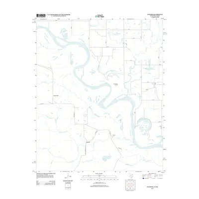
2013 Map of Acworth
USGS Topo · Published 2013About this map
The Red River defines the borderlands of this area, carving a winding path through the landscape near Acworth and Greenwood. This 2013 survey illustrates the complex hydrology of the river basin, featuring oxbow formations and cutoff channels like Lick-Skillet Cut-Off and Lick-Skillet Lake. The presence of Red Lake and Horseshoe Lake further suggests the river's historical shifts over time. Local history is anchored by Bachman Cem and the settlement at Acworth, while the surrounding terrain is drained by numerous tributaries such as Collier Cr, Sulpher Springs Cr, and Greenwood Br. This map captures a rural Texas landscape where family-named springs like Bryarly Springs and local landmarks like the Waterfall-Gilford Creeks Site 1 Reservoir remain vital components of the community's geographic identity.
Find a feature on this map
33 named features on this map. Tap any name to fly to it.
Don’t see what you’re looking for? This feature index may not catch every label — zoom into the map to look around manually.
Map Details
Editions of this 2013 Acworth Map
This is the sole edition of this map. No revisions or reprints were ever made.
Other maps of this area

1950 · Idabel
USGS Topo · 1:24,000

1950 · Acworth
USGS Topo · 1:24,000

1950 · White Rock
USGS Topo · 1:24,000

1951 · Idabel
USGS Topo · 1:24,000

1951 · Garvin
USGS Topo · 1:24,000

1951 · Idabel SE
USGS Topo · 1:24,000

1951 · English
USGS Topo · 1:24,000

1951 · White Rock
USGS Topo · 1:24,000

1951 · Acworth
USGS Topo · 1:24,000

1951 · Millerton
USGS Topo · 1:24,000