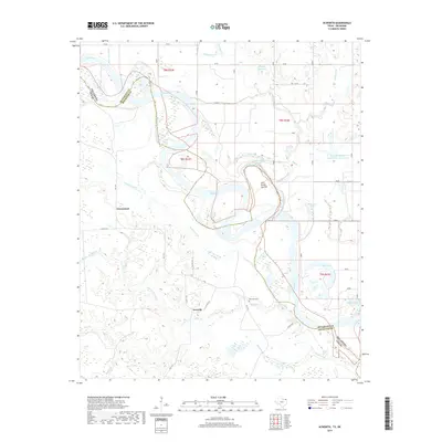
2019 Map of Acworth
USGS Topo · Published 2019About this map
The Red River defines the border landscape of this 2019 survey, carving a complex path between Texas and Oklahoma. This stretch of the river is characterized by dynamic fluvial features, most notably the Lick Skillet Cut-Off and the nearby Lick-Skillet Lake, which illustrate the shifting nature of the river channel over time. On the Texas side, the small settlements of Acworth and Greenwood anchor the local geography, connected by a network of rural roads such as FM 1159. Genealogists and local historians will find the Bachman Cem south of the river, while the surrounding terrain is marked by numerous water bodies including Horseshoe Lake, Red Lake, and Colbert Lake. The map also details several modern water management features, including the Waterfall-Gilford-Creeks Site 1 Reservoir, nestled among family-named landmarks like Byarly Springs and McKinsey Slough.
Find a feature on this map
39 named features on this map. Tap any name to fly to it.
Don’t see what you’re looking for? This feature index may not catch every label — zoom into the map to look around manually.
Map Details
Editions of this 2019 Acworth Map
This is the sole edition of this map. No revisions or reprints were ever made.
Other maps of this area

1950 · Idabel
USGS Topo · 1:24,000

1950 · Acworth
USGS Topo · 1:24,000

1950 · White Rock
USGS Topo · 1:24,000

1951 · Idabel
USGS Topo · 1:24,000

1951 · Garvin
USGS Topo · 1:24,000

1951 · Idabel SE
USGS Topo · 1:24,000

1951 · English
USGS Topo · 1:24,000

1951 · White Rock
USGS Topo · 1:24,000

1951 · Acworth
USGS Topo · 1:24,000

1951 · Millerton
USGS Topo · 1:24,000