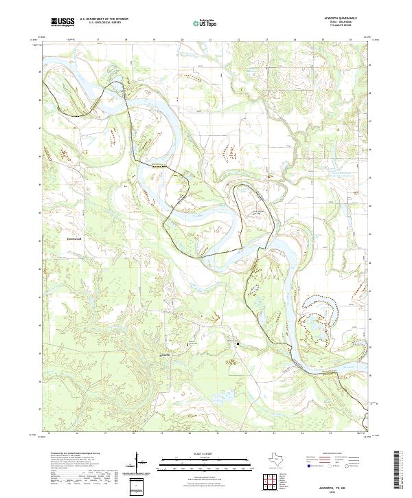
2022 Map of Acworth
USGS Topo · Published 2022About this map
The Red River defines the border between Texas and Oklahoma in this detailed survey of Red River County. The river's dynamic nature is evident in the oxbows and secondary water bodies like Lick-Skillet Lake and the nearby Lick-Skillet Cut-Off, which reveal the historical shifting of the main channel. Inland, the small settlements of Acworth and Greenwood anchor the rural landscape, connected by a network of local roads including FM 1159.
Find a feature on this map
38 named features on this map. Tap any name to fly to it.
Don’t see what you’re looking for? This feature index may not catch every label — zoom into the map to look around manually.
Map Details
Editions of this 2022 Acworth Map
This is the sole edition of this map. No revisions or reprints were ever made.
Other maps of this area

1950 · Idabel
USGS Topo · 1:24,000

1950 · Acworth
USGS Topo · 1:24,000

1950 · White Rock
USGS Topo · 1:24,000

1951 · Idabel
USGS Topo · 1:24,000

1951 · Garvin
USGS Topo · 1:24,000

1951 · Idabel SE
USGS Topo · 1:24,000

1951 · English
USGS Topo · 1:24,000

1951 · White Rock
USGS Topo · 1:24,000

1951 · Acworth
USGS Topo · 1:24,000

1951 · Millerton
USGS Topo · 1:24,000