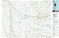
1984 Map of Ada
USGS Topo · Published 1985About this map
The Wild Rice River and Sand Hill River meander through the fertile Red River Valley landscape, defining the agricultural and hydrographic character of Norman County in the mid-1980s. This survey illustrates an intricate network of drainage systems, including Judicial Ditch No 52 and State Ditch No 68, which were vital for managing the flat terrain's water flow. The Burlington Northern railroad serves as the primary industrial spine, connecting established settlements like Ada and Fertile with smaller agricultural hubs such as Borup and Shelly. Along the eastern edge, the map documents the boundary of the White Earth Indian Reservation, highlighting a transition from the intensive drainage-ditch grid to more varied terrain. Numerous conservation areas, such as the Faith State Wildlife Management Area, are interspersed among the townships, preserving pockets of habitat amidst the vast expanse of cultivated land and prairie.
Find a feature on this map
100 named features on this map. Tap any name to fly to it.
Don’t see what you’re looking for? This feature index may not catch every label — zoom into the map to look around manually.
Map Details
Editions of this 1984 Ada Map
2 editions found
Other maps of this area

1895 · Fargo
USGS Topo · 1:125,000

1895 · Casselton
USGS Topo · 1:125,000

1897 · Fargo
USGS Topo · 1:125,000

1897 · Casselton
USGS Topo · 1:125,000

1918 · Kelso
USGS Topo · 1:62,500

1918 · Hendrum
USGS Topo · 1:62,500

1918 · Twin Valley
USGS Topo · 1:62,500

1918 · Flom
USGS Topo · 1:62,500

1918 · Ulen
USGS Topo · 1:62,500

1919 · Eldred
USGS Topo · 1:62,500