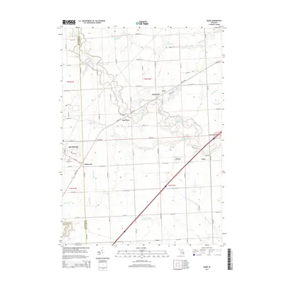
2014 Map of Adair
USGS Topo · Published 2014About this map
Richmond sits along the western edge of this landscape, where the border of Macomb and St. Clair counties meets. The area is defined by a dense network of drainage canals and small waterways, including Meldrum Drain and Swan Cr, which cut through the agricultural surroundings. Small historic clusters like Muttonville, Snyderville, and Adair are connected by major thoroughfares such as Gratiot Rd and Fred W Moore Hwy. Local heritage is anchored by sites like Saint Michaels Cem and Columbus Cem. The presence of the Robertson Field Airport near the center of the sheet reflects the modern utility of this primarily rural region. The Belle River meanders across the northern half, providing a natural focal point for the early settlement patterns of these southeastern Michigan townships.
Find a feature on this map
70 named features on this map. Tap any name to fly to it.
Don’t see what you’re looking for? This feature index may not catch every label — zoom into the map to look around manually.
Map Details
Editions of this 2014 Adair Map
This is the sole edition of this map. No revisions or reprints were ever made.
Other maps of this area

1912 · Mt Clemens
USGS Topo · 1:62,500

1914 · Armada
USGS Topo · 1:62,500

1914 · Algonac
USGS Topo · 1:62,500

1928 · Armada
USGS Topo · 1:62,500

1928 · Hicky
USGS Topo · 1:62,500

1929 · Mt Clemens
USGS Topo · 1:62,500

1936 · New Haven
USGS Topo · 1:31,680

1936 · Rattle Run
USGS Topo · 1:31,680

1936 · New Baltimore
USGS Topo · 1:31,680

1939 · New Baltimore
USGS Topo · 1:24,000