
1929 Map of Mt Clemens
USGS Topo · Published 1929About this map
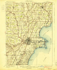
Mt Clemens serves as the regional hub in this 1920s survey of Macomb County, where the winding Clinton River meets the waters of Anchor Bay. The landscape is transitioning from rural townships like Ray and Macomb to an increasingly modernized corridor, evidenced by the presence of a Radio Station and the industrial activity of a Sugar Mill. To the east, the shoreline of Lake Saint Clair is defined by residential growth and aviation history at Selfridge Field, situated near the marshy reaches of Belvidere Bay.
Find a feature on this map
80 named features on this map. Tap any name to fly to it.
Don’t see what you’re looking for? This feature index may not catch every label — zoom into the map to look around manually.
Map Details
Editions of this 1929 Mt Clemens Map
4 editions found
Other maps of this area

1905 · Detroit
USGS Topo · 1:62,500

1905 · Grosse Pointe
USGS Topo · 1:62,500

1908 · Rochester
USGS Topo · 1:62,500

1912 · Mt Clemens
USGS Topo · 1:62,500

1914 · Armada
USGS Topo · 1:62,500

1914 · Algonac
USGS Topo · 1:62,500

1918 · Detroit
USGS Topo · 1:62,500

1918 · Grosse Pointe
USGS Topo · 1:62,500

1924 · Detroit
USGS Topo · 1:62,500

1928 · Armada
USGS Topo · 1:62,500