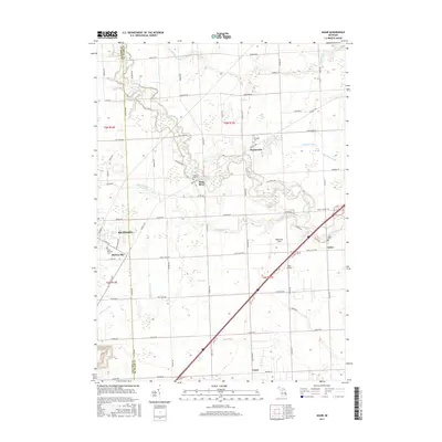
2017 Map of Adair
USGS Topo · Published 2017About this map
Richmond sits at the western edge of this agricultural and riparian landscape, where the town's grid meets the branching tributaries of the Belle River. The area is defined by a dense network of country roads following the Public Land Survey System, reflecting the deeply rooted farming heritage of both Macomb and St. Clair counties. Smaller community hubs like Muttonville, Snyderville, and Adair are scattered throughout the quadrangle, often anchored by local cemeteries such as Saint Michaels Cem or Adair Cem. The drainage pattern is particularly intricate here, with numerous named waterways like Swan Creek, Meldrum Drain, and Rattle Run carving through the fields. While much of the land remains dedicated to cultivation, small aviation landmarks such as Robertson Field and the Adair Airstrip indicate the continued utility of the open terrain.
Find a feature on this map
71 named features on this map. Tap any name to fly to it.
Don’t see what you’re looking for? This feature index may not catch every label — zoom into the map to look around manually.
Map Details
Editions of this 2017 Adair Map
This is the sole edition of this map. No revisions or reprints were ever made.
Other maps of this area

1912 · Mt Clemens
USGS Topo · 1:62,500

1914 · Armada
USGS Topo · 1:62,500

1914 · Algonac
USGS Topo · 1:62,500

1928 · Armada
USGS Topo · 1:62,500

1928 · Hicky
USGS Topo · 1:62,500

1929 · Mt Clemens
USGS Topo · 1:62,500

1936 · New Haven
USGS Topo · 1:31,680

1936 · Rattle Run
USGS Topo · 1:31,680

1936 · New Baltimore
USGS Topo · 1:31,680

1939 · New Baltimore
USGS Topo · 1:24,000