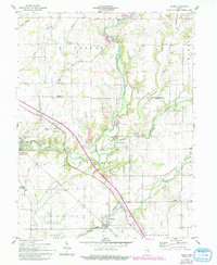
1959 Map of Adams
USGS Topo · Published 1993About this map
Flatrock River defines the landscape of northwestern Decatur County, carving a winding valley through a region primarily dedicated to agriculture and small limestone operations. This mid-century survey illustrates a network of rural settlements connected by the historic Michigan Road, which cuts diagonally across the terrain. While larger communities like Saint Paul and Saint Omer serve as local hubs, the map preserves the locations of smaller crossroads such as Downeyville and Adams. The presence of a YMCA Camp and a Quarry near Moscow indicates a varied land use that balances recreation with local industry. Genealogists will find considerable value in the numerous family-named burial sites documented here, including Arnold Cem, Aldridge Cem, and Mt Hebron Cem, which remain as markers of the area's early farmsteads.
Find a feature on this map
37 named features on this map. Tap any name to fly to it.
Don’t see what you’re looking for? This feature index may not catch every label — zoom into the map to look around manually.
Map Details
Editions of this 1959 Adams Map
3 editions found
Other maps of this area

1942 · Columbus
USGS Topo · 1:125,000

1953 · Cincinnati
USGS Topo · 1:250,000

1956 · Waldron
USGS Topo · 1:24,000

1956 · Rays Crossing
USGS Topo · 1:24,000

1957 · Cincinnati
USGS Topo · 1:250,000

1958 · Greensburg
USGS Topo · 1:24,000

1958 · Forest Hill
USGS Topo · 1:24,000

1958 · Hartsville
USGS Topo · 1:24,000

1959 · Milroy
USGS Topo · 1:24,000

1959 · Rushville
USGS Topo · 1:24,000