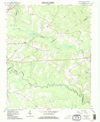
1966 Map of Adams Grove
USGS Topo · Published 1986About this map
The Meherrin River meanders through this portion of Southside Virginia, where the convergence of Sussex, Southampton, and Greensville counties forms a landscape dominated by extensive swamp networks. Local history is anchored at the rural hubs of Grizzard, Green Plain, and Adams Grove, with the transition of regional transportation evidenced by the Norfolk and Western rail line and an older Old Railroad Grade cutting across the northern reaches. The area's settlement pattern is highlighted by local family and community landmarks, including Atkins Cem and the Oak Grove Ch, while the Emporia Municipal Airport appears as a modern development in the western portion of the quadrangle. Hydrological features like Three Creek and Bellyache Swamp illustrate the drainage patterns that shaped local agriculture and early timber harvesting in this coastal plain region.
Find a feature on this map
27 named features on this map. Tap any name to fly to it.
Don’t see what you’re looking for? This feature index may not catch every label — zoom into the map to look around manually.
Map Details
Editions of this 1966 Adams Grove Map
Other maps of this area

1919 · Jarratt
USGS Topo · 1:62,500

1919 · Mc Kenney
USGS Topo · 1:48,000

1919 · Emporia
USGS Topo · 1:62,500

1919 · Arringdale
USGS Topo · 1:48,000

1920 · Arringdale
USGS Topo · 1:62,500

1921 · Mc Kenney
USGS Topo · 1:62,500

1942 · Arringdale
USGS Topo · 1:62,500

1942 · Emporia
USGS Topo · 1:62,500

1943 · Mc Kenney
USGS Topo · 1:62,500

1951 · Jarratt
USGS Topo · 1:62,500