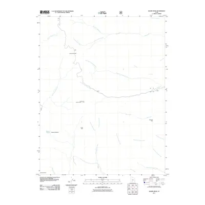
2011 Map of Adams Head
USGS Topo · Published 2011About this map
Powell Survey Adams Head Cairn stands as a significant historical marker on this high plateau in Garfield County, anchoring a landscape defined by an intricate network of drainage forks. This 2011 survey illustrates the complex hydrology of the region, where the North Fork Cottonwood Creek and South Fork Cottonwood Creek converge amidst high-elevation summits like Cottonwood Peak and Crow Peak. The map reveals a transition from open alpine spaces such as Marshall Meadow to the sharp relief of Window Rock. Geologists and researchers will find the precise mapping of intermittent streams, including the North Fork Prospect Creek and Right Fork Sanford Creek, vital for understanding the watershed patterns of this portion of the Utah backcountry before further modern development occurred.
Find a feature on this map
27 named features on this map. Tap any name to fly to it.
Don’t see what you’re looking for? This feature index may not catch every label — zoom into the map to look around manually.
Map Details
Editions of this 2011 Adams Head Map
This is the sole edition of this map. No revisions or reprints were ever made.
Other maps of this area

1885 · Beaver
USGS Topo · 1:250,000

1886 · Kanab
USGS Topo · 1:250,000

1953 · Richfield
USGS Topo · 1:250,000

1953 · Cedar City
USGS Topo · 1:250,000

1958 · Richfield
USGS Topo · 1:250,000

1958 · Cedar City
USGS Topo · 1:250,000

1962 · Cedar City
USGS Topo · 1:250,000

1966 · Bull Rush Peak
USGS Topo · 1:24,000
1971 · Flake Mtn East
USGS Topo · 1:24,000
1971 · Deep Creek
USGS Topo · 1:24,000