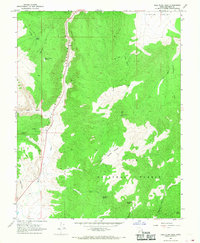
1966 Map of Bull Rush Peak
USGS Topo · Published 1968About this map
The Sevier River carves a path through the steep landscape of Circleville Canyon in this mid-1960s study of the Utah terrain. This area, largely defined by the Dixie National Forest, shows a high-elevation landscape marked by dramatic peaks like Bull Rush Peak and Horse Valley Peak. Water management and natural springs are central to the region's character, evidenced by the Bucket Hollow Reservoir, Bull Rush Spring, and Marks Pond.
Find a feature on this map
31 named features on this map. Tap any name to fly to it.
Don’t see what you’re looking for? This feature index may not catch every label — zoom into the map to look around manually.
Map Details
Editions of this 1966 Bull Rush Peak Map
This is the sole edition of this map. No revisions or reprints were ever made.
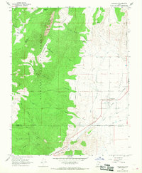
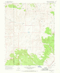
Other maps of this area

1885 · Beaver
USGS Topo · 1:250,000

1886 · Kanab
USGS Topo · 1:250,000

1953 · Richfield
USGS Topo · 1:250,000

1953 · Cedar City
USGS Topo · 1:250,000

1958 · Richfield
USGS Topo · 1:250,000

1958 · Cedar City
USGS Topo · 1:250,000

1962 · Cedar City
USGS Topo · 1:250,000
1966 · Circleville
USGS Topo · 1:24,000
1966 · Fremont Pass
USGS Topo · 1:24,000

1966 · Junction
USGS Topo · 1:24,000