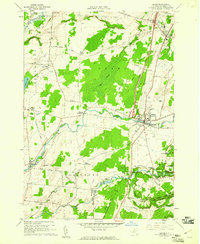
1959 Map of Adams
USGS Topo · Published 1961About this map
Sandy Creek flows through the heart of this Jefferson County landscape, anchoring the principal settlements of Adams and Adams Center. The late 1950s terrain is marked by a network of rural hamlets and family-named landmarks, reflecting a deep agricultural history. Notable concentrations of small communities such as Thomas Settlement, Taylor Settlement, and Green Settlement illustrate the localized settlement patterns of the era. The presence of several burial grounds, including Evergreen Cem and St Johns Cem, alongside the St Cecelias Ch, provides significant value for genealogists tracing local families.
Find a feature on this map
62 named features on this map. Tap any name to fly to it.
Don’t see what you’re looking for? This feature index may not catch every label — zoom into the map to look around manually.
Map Details
Editions of this 1959 Adams Map
3 editions found
Other maps of this area

1893 · Sackets Harbor
USGS Topo · 1:62,500

1895 · Sacketts Harbor
USGS Topo · 1:62,500

1895 · Pulaski
USGS Topo · 1:62,500

1895 · Watertown
USGS Topo · 1:62,500

1898 · Watertown
USGS Topo · 1:62,500

1903 · Orwell
USGS Topo · 1:62,500

1905 · Orwell
USGS Topo · 1:62,500

1908 · Watertown
USGS Topo · 1:62,500

1909 · Watertown
USGS Topo · 1:62,500

1942 · Henderson Bay
USGS Topo · 1:31,680