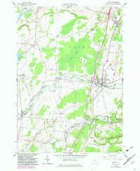
1959 Map of Adams
USGS Topo · Published 1983About this map
Sandy Creek snakes through this Jefferson County landscape, anchoring a network of small agricultural hamlets and family settlements during the mid-20th century. The village of Adams and the nearby Adams Center serve as the primary hubs of activity, linked by the Conrail railroad and the Empire Stateway. Beyond these centers, the map reveals a dense distribution of rural genealogy markers, including Thomas Settlement, Green Settlement, and several small burial grounds like St Johns Cem and Grow Cem.
Find a feature on this map
72 named features on this map. Tap any name to fly to it.
Don’t see what you’re looking for? This feature index may not catch every label — zoom into the map to look around manually.
Map Details
Editions of this 1959 Adams Map
3 editions found
Other maps of this area

1893 · Sackets Harbor
USGS Topo · 1:62,500

1895 · Sacketts Harbor
USGS Topo · 1:62,500

1895 · Pulaski
USGS Topo · 1:62,500

1895 · Watertown
USGS Topo · 1:62,500

1898 · Watertown
USGS Topo · 1:62,500

1903 · Orwell
USGS Topo · 1:62,500

1905 · Orwell
USGS Topo · 1:62,500

1908 · Watertown
USGS Topo · 1:62,500

1909 · Watertown
USGS Topo · 1:62,500

1942 · Henderson Bay
USGS Topo · 1:31,680