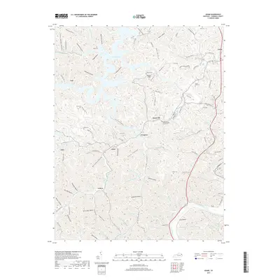
2019 Map of Adams
USGS Topo · Published 2019About this map
Yatesville Lake dominates the northern landscape of this Lawrence County quadrangle, where modern reservoir management meets long-established Appalachian hollows. The settlement of Louisa sits at the northeastern edge, while smaller communities like Busseyville, Evergreen, and Adams are distributed along the narrow valley floors. The complex topography is defined by dozens of named hollows, including Fern Hollow, Robinett Hollow, and Rockhouse Hollow, which reveal the intricate drainage patterns feeding into the Levisa Fork.
Find a feature on this map
136 named features on this map. Tap any name to fly to it.
Don’t see what you’re looking for? This feature index may not catch every label — zoom into the map to look around manually.
Map Details
Editions of this 2019 Adams Map
This is the sole edition of this map. No revisions or reprints were ever made.
Other maps of this area

1886 · Prestonsburg
USGS Topo · 1:125,000

1892 · Prestonsburg
USGS Topo · 1:125,000

1903 · Kenova
USGS Topo · 1:125,000

1904 · Kenova
USGS Topo · 1:125,000

1911 · Louisa
USGS Topo · 1:48,000

1913 · Louisa
USGS Topo · 1:62,500

1914 · Inez
USGS Topo · 1:48,000

1915 · Paintsville
USGS Topo · 1:48,000

1916 · Inez
USGS Topo · 1:62,500

1917 · Paintsville
USGS Topo · 1:62,500