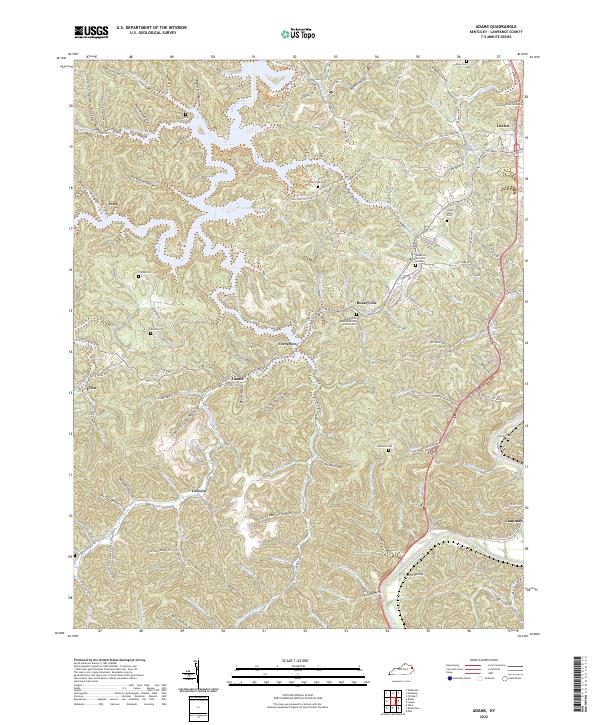
2022 Map of Adams
USGS Topo · Published 2022About this map
Blaine Creek and its many winding tributaries like Carter Branch and Harriet Br carve through the deep hollows of Lawrence County, forming the primary drainage system for this corner of Kentucky. Small settlements such as Evergreen, Adams, and Busseyville are centered at the junctions of these waterways and the local ridge roads. The eastern edge of the map is defined by the larger Levisa Fork, where the landscape transitions toward the county seat at Louisa.
Find a feature on this map
76 named features on this map. Tap any name to fly to it.
Don’t see what you’re looking for? This feature index may not catch every label — zoom into the map to look around manually.
Map Details
Editions of this 2022 Adams Map
This is the sole edition of this map. No revisions or reprints were ever made.
Other maps of this area

1886 · Prestonsburg
USGS Topo · 1:125,000

1892 · Prestonsburg
USGS Topo · 1:125,000

1903 · Kenova
USGS Topo · 1:125,000

1904 · Kenova
USGS Topo · 1:125,000

1911 · Louisa
USGS Topo · 1:48,000

1913 · Louisa
USGS Topo · 1:62,500

1914 · Inez
USGS Topo · 1:48,000

1915 · Paintsville
USGS Topo · 1:48,000

1916 · Inez
USGS Topo · 1:62,500

1917 · Paintsville
USGS Topo · 1:62,500