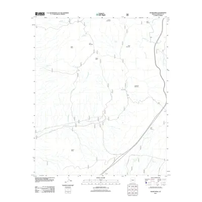
2011 Map of Adams Mesa
USGS Topo · Published 2011About this map
Adams Mesa and its surrounding desert topography define this high-altitude landscape in Maricopa County. This early 21st-century survey documents a complex network of seasonal water sources and landmarks essential for navigating the arid environment, such as Sheep Camp and the Desert Vista Viewpoint. The terrain is characterized by prominent elevations including Lone Mountain, Black Mountain, and Sugarloaf Mountain, which rise between the drainages of Ironwood Wash and the winding Sycamore Creek. Human presence is evidenced through specialized infrastructure like Mesquite Spring Tank, Hughes Tank, and Palo Fiero Tank, used to manage scarce water resources for livestock or land management. Transportation is marked by the N Old Bush Hwy and various service routes, providing access to remote points across the mesas and canyons.
Find a feature on this map
26 named features on this map. Tap any name to fly to it.
Don’t see what you’re looking for? This feature index may not catch every label — zoom into the map to look around manually.
Map Details
Editions of this 2011 Adams Mesa Map
This is the sole edition of this map. No revisions or reprints were ever made.
Other maps of this area

1904 · Ft. McDowell
USGS Topo · 1:62,500

1906 · Ft. McDowell
USGS Topo · 1:62,500

1907 · Roosevelt
USGS Topo · 1:125,000

1909 · Four Peaks
USGS Topo · 1:125,000

1912 · Roosevelt
USGS Topo · 1:125,000

1930 · Cave Creek
USGS Topo · 1:125,000

1939 · Cave Creek
USGS Topo · 1:125,000

1954 · Mesa
USGS Topo · 1:250,000

1957 · Mesa
USGS Topo · 1:250,000

1958 · Mesa
USGS Topo · 1:250,000