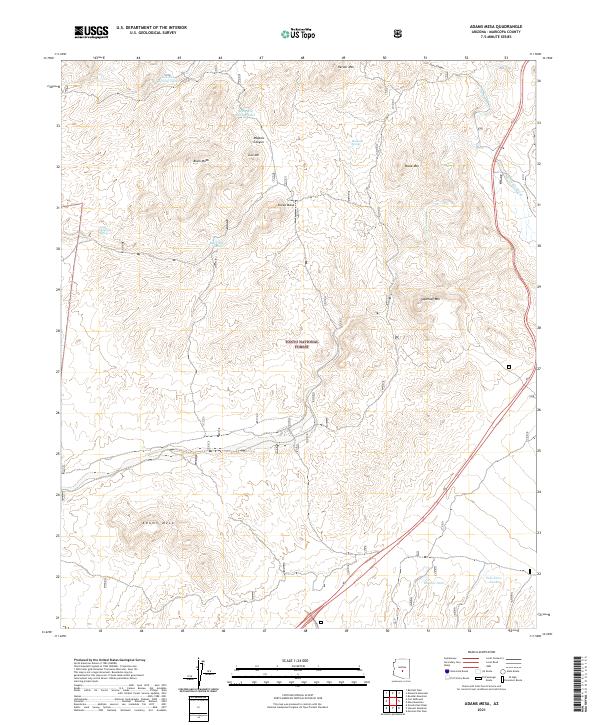
2021 Map of Adams Mesa
USGS Topo · Published 2021About this map
Tonto National Forest defines this high-desert landscape in northeastern Maricopa County, characterized by a series of prominent mesas and volcanic landforms. The topography is anchored by the namesake Adams Mesa in the south, while Sugarloaf Mtn and Sheep Mesa dominate the central terrain. This area serves as a critical watershed, where seasonal water sources like Aqua Chiquita Spring and Mesquite Spring provide life in an arid environment. Drainage patterns are clearly defined by Sycamore Cr and Mesquite Wash, which cut through deep relief such as Malpais Canyon. For the researcher, the map details a network of cattle tanks including Hughes Tank and Black Mesa Tanks, illustrating the intersection of natural hydrology and ranching infrastructure within the protected forest boundaries.
Find a feature on this map
37 named features on this map. Tap any name to fly to it.
Don’t see what you’re looking for? This feature index may not catch every label — zoom into the map to look around manually.
Map Details
Editions of this 2021 Adams Mesa Map
This is the sole edition of this map. No revisions or reprints were ever made.
Other maps of this area

1904 · Ft. McDowell
USGS Topo · 1:62,500

1906 · Ft. McDowell
USGS Topo · 1:62,500

1907 · Roosevelt
USGS Topo · 1:125,000

1909 · Four Peaks
USGS Topo · 1:125,000

1912 · Roosevelt
USGS Topo · 1:125,000

1930 · Cave Creek
USGS Topo · 1:125,000

1939 · Cave Creek
USGS Topo · 1:125,000

1954 · Mesa
USGS Topo · 1:250,000

1957 · Mesa
USGS Topo · 1:250,000

1958 · Mesa
USGS Topo · 1:250,000