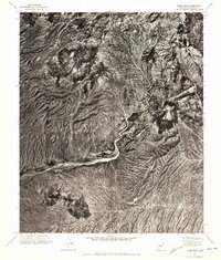
1971 Map of Adams Mesa
USGS Topo · Published 1972About this map
Sugarloaf Mtn and Herder Mtn dominate the arid, high-relief landscape of this 1971 orthophotoquad in Maricopa County. Unlike traditional topographic maps that use contour lines to represent elevation, this photogrammetric mosaic provides a direct aerial perspective of the scrub-covered ridges and desert floor. The visual texture of the land reveals the complex drainage patterns of the Creek and its unnamed tributaries as they cut through the rocky terrain. This specific format, based on 1:78,000-scale aerial photographs, emphasizes the natural geomorphology of the area over man-made structures, offering a clear record of the undisturbed environment in central Arizona during the early 1970s.
Find a feature on this map
3 named features on this map. Tap any name to fly to it.
Don’t see what you’re looking for? This feature index may not catch every label — zoom into the map to look around manually.
Map Details
Editions of this 1971 Adams Mesa Map
This is the sole edition of this map. No revisions or reprints were ever made.
Other maps of this area

1904 · Ft. McDowell
USGS Topo · 1:62,500

1906 · Ft. McDowell
USGS Topo · 1:62,500

1907 · Roosevelt
USGS Topo · 1:125,000

1909 · Four Peaks
USGS Topo · 1:125,000

1912 · Roosevelt
USGS Topo · 1:125,000

1930 · Cave Creek
USGS Topo · 1:125,000

1939 · Cave Creek
USGS Topo · 1:125,000

1954 · Mesa
USGS Topo · 1:250,000

1957 · Mesa
USGS Topo · 1:250,000

1958 · Mesa
USGS Topo · 1:250,000