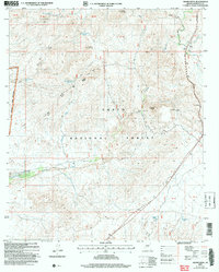
2004 Map of Adams Mesa
USGS Topo · Published 2007About this map
Adams Mesa and the surrounding high desert terrain dominate this landscape within the Tonto National Forest. The map documents a rugged topography of mesas and peaks, including Sugarloaf Mountain, Black Mountain, and Sheep Mesa. Hydrological features are critical in this arid environment, marked by a network of seasonal drainages like Sycamore Creek and Cave Creek, alongside numerous livestock and wildlife watering points such as Block Mesa Tanks, Hughes Tanks, and Pato Fierro Tank. The western edge of the quadrangle is defined by the Fort McDowell Indian Reservation Bdy. This 2004 revision by the Forest Service provides a detailed look at the public land survey system and administrative boundaries, including the Ranger District lines, at a time when the region's management relied on a mix of legacy topography and modern imagery.
Find a feature on this map
28 named features on this map. Tap any name to fly to it.
Don’t see what you’re looking for? This feature index may not catch every label — zoom into the map to look around manually.
Map Details
Editions of this 2004 Adams Mesa Map
This is the sole edition of this map. No revisions or reprints were ever made.
Other maps of this area

1904 · Ft. McDowell
USGS Topo · 1:62,500

1906 · Ft. McDowell
USGS Topo · 1:62,500

1907 · Roosevelt
USGS Topo · 1:125,000

1909 · Four Peaks
USGS Topo · 1:125,000

1912 · Roosevelt
USGS Topo · 1:125,000

1930 · Cave Creek
USGS Topo · 1:125,000

1939 · Cave Creek
USGS Topo · 1:125,000

1954 · Mesa
USGS Topo · 1:250,000

1957 · Mesa
USGS Topo · 1:250,000

1958 · Mesa
USGS Topo · 1:250,000