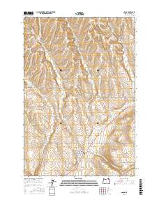
2017 Map of Adams
USGS Topo · Published 2017About this map
Adams serves as the central hub of this agricultural landscape in Umatilla County, where the town grid is defined by streets like College St and William St. The surrounding terrain is a complex network of drainages and flatlands essential to the region's dryland farming legacy, including the broad Gerking Flat and the deep incision of Waterman Gulch. Water management is evident through the winding paths of Wildhorse Cr and Greasewood Cr, which dictate the placement of rural infrastructure. For those tracing local history, the Athena Cem sits on the eastern edge of the quadrangle near Athena Cemetery Rd. The map also details numerous family-named routes and geographical landmarks such as Sand Hollow and Spring Hollow, illustrating how the early twentieth-century rural road network evolved to support the wheat-growing plateaus of eastern Oregon.
Find a feature on this map
43 named features on this map. Tap any name to fly to it.
Don’t see what you’re looking for? This feature index may not catch every label — zoom into the map to look around manually.
Map Details
Editions of this 2017 Adams Map
This is the sole edition of this map. No revisions or reprints were ever made.
Other maps of this area

1935 · Pendleton
USGS Topo · 1:125,000

1953 · Pendleton
USGS Topo · 1:250,000

1956 · Pendleton
USGS Topo · 1:250,000

1964 · Milton-Freewater
USGS Topo · 1:24,000

1964 · Thorn Hollow
USGS Topo · 1:24,000

1964 · Athena
USGS Topo · 1:24,000
1966 · Adams
USGS Topo · 1:24,000
1966 · Smeltz
USGS Topo · 1:24,000
1966 · Cayuse
USGS Topo · 1:24,000

1966 · Mission
USGS Topo · 1:24,000