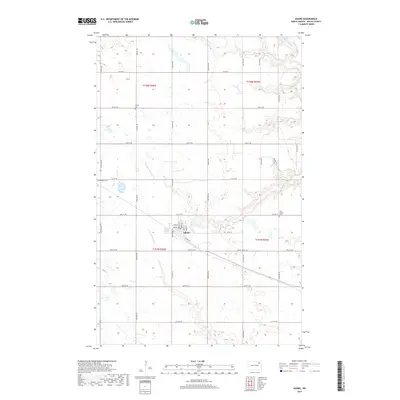
2017 Map of Adams
USGS Topo · Published 2017About this map
Adams serves as the central hub of this agricultural landscape in Walsh County, where a tidy grid of residential streets like Main St and Vesta St meets the open prairie. The township structure is defined by a meticulous network of section-line roads, such as Co Hwy 9 and 117th Ave NE, which partition the vast North Dakota plains. Significant local history is preserved in the placement of community burial grounds, including Trinity Cem to the north and the West Adams Cem and East Adams Cem surrounding the town site. The hydrology of the region is marked by the meandering paths of the N Br Forest River and the S Br Park River, which break the geometric regularity of the farmland. This survey highlights the enduring rural layout of the northern Red River Valley periphery, where named routes like Prairie Trl connect scattered farmsteads.
Find a feature on this map
38 named features on this map. Tap any name to fly to it.
Don’t see what you’re looking for? This feature index may not catch every label — zoom into the map to look around manually.
Map Details
Editions of this 2017 Adams Map
This is the sole edition of this map. No revisions or reprints were ever made.
Other maps of this area

1952 · Thief River Falls
USGS Topo · 1:250,000

1953 · Devils Lake
USGS Topo · 1:250,000

1956 · Thief River Falls
USGS Topo · 1:250,000

1956 · Devils Lake
USGS Topo · 1:250,000

1957 · Thief River Falls
USGS Topo · 1:250,000

1967 · Thief River Falls
USGS Topo · 1:250,000

1972 · Osnabrock SW
USGS Topo · 1:24,000

1972 · Adams
USGS Topo · 1:24,000
1972 · Edinburg NW
USGS Topo · 1:24,000

1972 · Adams SW
USGS Topo · 1:24,000