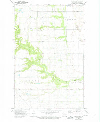
1972 Map of Edinburg NW
USGS Topo · Published 1975About this map
The South Branch Park River carves a distinct, wooded corridor through the agricultural landscape of Walsh County in the early 1970s. This survey of the northwestern Edinburg vicinity reveals a rural settlement pattern defined by isolated country churches and local township landmarks. Along the southern edge of the sheet, the Soo Line railroad cuts across the prairie, reflecting the transportation backbone of the Red River Valley's farming economy.
Find a feature on this map
15 named features on this map. Tap any name to fly to it.
Don’t see what you’re looking for? This feature index may not catch every label — zoom into the map to look around manually.
Map Details
Editions of this 1972 Edinburg NW Map
This is the sole edition of this map. No revisions or reprints were ever made.
Other maps of this area

1952 · Thief River Falls
USGS Topo · 1:250,000

1953 · Devils Lake
USGS Topo · 1:250,000

1956 · Thief River Falls
USGS Topo · 1:250,000

1956 · Devils Lake
USGS Topo · 1:250,000

1957 · Thief River Falls
USGS Topo · 1:250,000

1963 · Edinburg
USGS Topo · 1:24,000

1963 · Pleasant Valley
USGS Topo · 1:24,000

1963 · Gardar
USGS Topo · 1:24,000

1967 · Thief River Falls
USGS Topo · 1:250,000

1972 · Adams
USGS Topo · 1:24,000