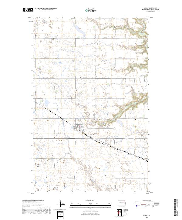
2024 Map of Adams
USGS Topo · Published 2024About this map
The town of Adams sits at the heart of this Walsh County landscape, organized around a traditional grid of streets including Main St, Park St, and Kongsberg St. The surrounding countryside is defined by the winding paths of the North Branch Forest River and the South Branch Park River, which drain the varied topography of the Red River Valley upland. Agriculture and conservation coexist here, evidenced by the large Walsh County Waterfowl Production Area in the northern sections. Genealogists will find local history anchored by the Trinity Cem and East Adams Cem, while the modern road network, including Co Hwy 9 and Co Hwy 16, follows the rigid section lines of the Public Land Survey System, occasionally interrupted by the more fluid path of the Prairie Trl.
Find a feature on this map
40 named features on this map. Tap any name to fly to it.
Don’t see what you’re looking for? This feature index may not catch every label — zoom into the map to look around manually.
Map Details
Editions of this 2024 Adams Map
This is the sole edition of this map. No revisions or reprints were ever made.
Other maps of this area

1952 · Thief River Falls
USGS Topo · 1:250,000

1953 · Devils Lake
USGS Topo · 1:250,000

1956 · Thief River Falls
USGS Topo · 1:250,000

1956 · Devils Lake
USGS Topo · 1:250,000

1957 · Thief River Falls
USGS Topo · 1:250,000

1967 · Thief River Falls
USGS Topo · 1:250,000

1972 · Osnabrock SW
USGS Topo · 1:24,000

1972 · Adams
USGS Topo · 1:24,000
1972 · Edinburg NW
USGS Topo · 1:24,000

1972 · Adams SW
USGS Topo · 1:24,000