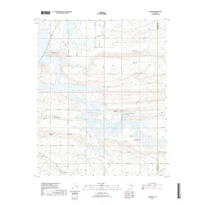
2018 Map of Adamson
USGS Topo · Published 2018About this map
Adamson and Dow anchor this landscape along the border of Pittsburg and Latimer counties, where the high ridges of the Ouachita foothills meet the southern reaches of Eufaula Lake. The map reveals a settlement pattern tied to the topography, with local travel defined by routes like Old US Hwy 270 and Carbon Rd. Family and community history is preserved in several small burial grounds, including Adamson Cem, Cole Chapel Cem, and Kemp Cem, which are scattered among the ridges of Fish Trap Mtn and Pocahontas Mtn.
Find a feature on this map
67 named features on this map. Tap any name to fly to it.
Don’t see what you’re looking for? This feature index may not catch every label — zoom into the map to look around manually.
Map Details
Editions of this 2018 Adamson Map
This is the sole edition of this map. No revisions or reprints were ever made.
Other maps of this area

1898 · McAlester
USGS Topo · 1:125,000

1900 · Sansbois
USGS Topo · 1:125,000

1900 · Canadian
USGS Topo · 1:125,000

1901 · Tuskahoma
USGS Topo · 1:125,000

1908 · Tuskahoma
USGS Topo · 1:125,000

1909 · Mc Alester
USGS Topo · 1:125,000

1909 · Tuskahoma
USGS Topo · 1:125,000

1909 · Sans Bois
USGS Topo · 1:125,000

1911 · Sansbois
USGS Topo · 1:125,000

1946 · Fort Smith
USGS Topo · 1:250,000