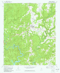
1969 Map of Addison
USGS Topo · Published 1981About this map
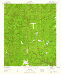
Lewis Smith Lake dominates the southern landscape of this Winston County region, where the winding inlets of Brushy Creek and Rock Creek meet the forested shoreline. The town of Addison serves as the central hub, situated just north of the William B Bankhead National Forest boundary. This 1969 field-checked survey illustrates a rural community anchored by longstanding institutions, including the High Sch in town and several outlying country churches such as Friendship Ch and Liberty Ch. Genealogical value is found in several burial sites like Old Houston Cem and Pisgah Cem, which are scattered throughout the hills. The terrain is defined by dramatic water features, notably the sharp curve of Horseshoe Bend and the convergence of numerous small branches like Chimney Branch and Clifty Creek as they drain toward the reservoir.
Find a feature on this map
33 named features on this map. Tap any name to fly to it.
Don’t see what you’re looking for? This feature index may not catch every label — zoom into the map to look around manually.
Map Details
Editions of this 1969 Addison Map
4 editions found
Other maps of this area

1935 · Upshaw
USGS Topo · 1:24,000

1935 · Danville
USGS Topo · 1:48,000

1936 · Mc Kendry
USGS Topo · 1:24,000

1936 · Moulton
USGS Topo · 1:48,000

1938 · Danville
USGS Topo · 1:62,500

1940 · Mt Hope
USGS Topo · 1:62,500

1956 · Gadsden
USGS Topo · 1:250,000

1958 · Gadsden
USGS Topo · 1:250,000

1960 · Gadsden
USGS Topo · 1:250,000
1960 · Grayson
USGS Topo · 1:24,000