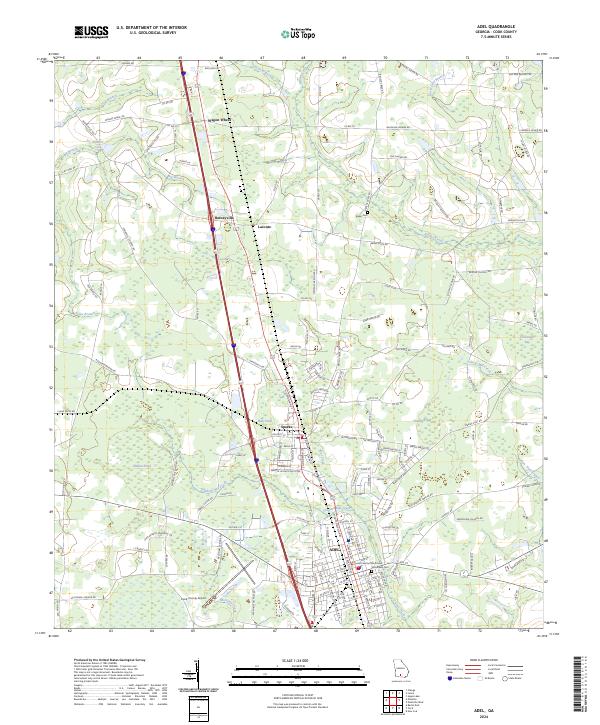
2024 Map of Adel
USGS Topo · Published 2024About this map
Adel serves as the primary hub of this South Georgia landscape, situated alongside its neighbor Sparks in a region defined by agricultural heritage and a dense network of blackwater streams. The Cook County Courthouse stands as a central landmark within the city grid, while the surrounding countryside is marked by distinct depression wetlands known locally as bays, including Thornhill Bay and Crossroads Bay. These features, along with the meandering courses of Bear Creek and Giddens Mill Creek, illustrate the low-lying, water-rich geography of the coastal plain. Transport corridors dominate the north-south axis, connecting the smaller settlements of Barneyville, Laconte, and Wagon Wheel. Long-established family and community sites like Woodlawn Cemetery and Baker Cemetery provide essential points of reference for genealogical research, while the Cook County Airport reflects the modernization of this rural area.
Find a feature on this map
162 named features on this map. Tap any name to fly to it.
Don’t see what you’re looking for? This feature index may not catch every label — zoom into the map to look around manually.
Map Details
Editions of this 2024 Adel Map
This is the sole edition of this map. No revisions or reprints were ever made.
Other maps of this area

1953 · Waycross
USGS Topo · 1:250,000

1958 · Waycross
USGS Topo · 1:250,000

1973 · Adel
USGS Topo · 1:24,000

1973 · New Lois
USGS Topo · 1:24,000

1973 · Sapps Lake
USGS Topo · 1:24,000

1973 · Cecil
USGS Topo · 1:24,000

1973 · Nashville West
USGS Topo · 1:24,000

1973 · Lenox
USGS Topo · 1:24,000

1973 · Omega
USGS Topo · 1:24,000

1974 · Berlin East
USGS Topo · 1:24,000