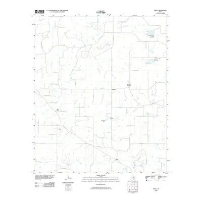
2010 Map of Adell
USGS Topo · Published 2010About this map
Adell and Advance serve as the primary hubs for this rural landscape in north-central Texas during the early 21st century. The terrain is defined by low-lying ridges including Slipdown Mountain and Bald Knob, with the Clear Fork Trinity River cutting across the northern reaches of the quadrangle. Local landmarks such as the Blo Airport and Rish Cemetery provide specific points of interest for genealogists and local historians, while the presence of the Soil Conservation Service Site 1 Dam and Soil Conservation Service Site 2 Dam reflects modern water management and land use patterns. Numerous drainages, including Gourdneck Creek, Cottonwood Creek, and the East Fork Rock Creek, create a complex network of seasonal and perennial waterways that cross a grid of rural roads like Lone Star Rd and Ballard Rd.
Find a feature on this map
57 named features on this map. Tap any name to fly to it.
Don’t see what you’re looking for? This feature index may not catch every label — zoom into the map to look around manually.
Map Details
Editions of this 2010 Adell Map
This is the sole edition of this map. No revisions or reprints were ever made.
Other maps of this area

1891 · Weatherford
USGS Topo · 1:125,000

1891 · Palo Pinto
USGS Topo · 1:125,000

1893 · Weatherford
USGS Topo · 1:125,000

1918 · Palo Pinto
USGS Topo · 1:125,000

1927 · Mineral Wells
USGS Topo · 1:62,500

1954 · Dallas
USGS Topo · 1:250,000

1954 · Sherman
USGS Topo · 1:250,000

1954 · Abilene
USGS Topo · 1:250,000

1954 · Wichita Falls
USGS Topo · 1:250,000

1958 · Dallas
USGS Topo · 1:250,000