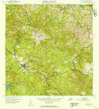
1952 Map of Adjuntas
USGS Topo · Published 1953About this map
Adjuntas and its surrounding barrios are depicted here in the early 1950s, revealing a landscape defined by traditional haciendas and a developing mountain infrastructure. The presence of numerous named estates such as Hacienda Tres Hermanas, Hacienda Santa Elena, and Hacienda La Gloria suggests the enduring importance of the region's agricultural heritage. These settlements are interspersed with modern mid-century developments, including the Planta de Filtracion and Planta Hidroelectrica No 2, signaling the integration of industrial utilities into the Cordillera Central.
Find a feature on this map
77 named features on this map. Tap any name to fly to it.
Don’t see what you’re looking for? This feature index may not catch every label — zoom into the map to look around manually.
Map Details
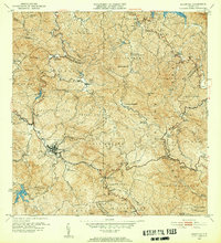
Editions of this 1952 Adjuntas Map
2 editions found
Other maps of this area

1945 · Ponce
USGS Topo · 1:30,000

1946 · Utuado
USGS Topo · 1:30,000

1946 · Bayaney
USGS Topo · 1:30,000

1946 · Yauco
USGS Topo · 1:30,000

1946 · Jayuya
USGS Topo · 1:30,000

1946 · Monte Guilarte
USGS Topo · 1:30,000

1946 · Florida
USGS Topo · 1:30,000

1946 · Penuelas
USGS Topo · 1:30,000

1946 · Adjuntas
USGS Topo · 1:30,000
1947 · Yauco NE
USGS Topo · 1:10,000
Featured Places
- Adjuntas
- Sector Vickey Oquendo, Adjuntas
- Barriada La Olimpia, Adjuntas
- Sector Los Verdes, Adjuntas
- Altos de Arena, Utuado