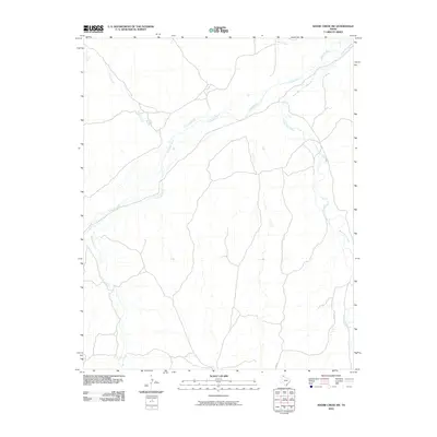
2010 Map of Adobe Creek SW
USGS Topo · Published 2010About this map
The Canadian River cuts a wide, braided path across this portion of the Texas Panhandle, defining the drainage patterns of the surrounding Hutchinson County landscape. Tributaries such as Carson Creek and Spring Creek flow toward the main river channel from the west, while the eastern section is dominated by the winding course of White Deer Creek. This area is characterized by the expansive open terrain typical of the Llano Estacado, where water sources dictate the placement of local infrastructure. Rural transport is facilitated by a network of local routes including Co Rd 26 and Co Rd 28, which navigate the elevation changes between the high plains and the river valley. The map documents the persistent natural hydrology of the region, including smaller drainages like Bent Creek near the northern boundary.
Find a feature on this map
7 named features on this map. Tap any name to fly to it.
Don’t see what you’re looking for? This feature index may not catch every label — zoom into the map to look around manually.
Map Details
Editions of this 2010 Adobe Creek SW Map
This is the sole edition of this map. No revisions or reprints were ever made.
Other maps of this area

1953 · Plemons
USGS Topo · 1:24,000

1953 · Stinnett Station
USGS Topo · 1:24,000

1953 · Phillips
USGS Topo · 1:24,000

1954 · Amarillo
USGS Topo · 1:250,000

1958 · Amarillo
USGS Topo · 1:250,000

1970 · Phillips
USGS Topo · 1:24,000

1971 · Skellytown NW
USGS Topo · 1:24,000

1971 · Skellytown NE
USGS Topo · 1:24,000

1971 · Adobe Creek SW
USGS Topo · 1:24,000

1971 · Garden Springs
USGS Topo · 1:24,000