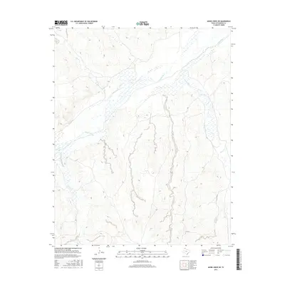
2016 Map of Adobe Creek SW
USGS Topo · Published 2016About this map
The Canadian River cuts a wide, braided path through the High Plains landscape of Hutchinson County, defining the hydrology and topography of this region. This modern survey illustrates the intricate drainage systems feeding into the river, including Carson Cr from the north and White Deer Cr from the east. The terrain is marked by the sharp relief of river-cut breaks, where the land drops away from the surrounding plains into the valley. Unlike many areas with dense settlement, this portion of the Texas Panhandle remains largely defined by its natural watercourses and sparse infrastructure. Only limited rural transport is noted, such as Co RD 26, highlighting the open character of the country. Minor tributaries like Spring Cr and Moore Cr trace the erosion patterns that have sculpted this landscape over time.
Find a feature on this map
6 named features on this map. Tap any name to fly to it.
Don’t see what you’re looking for? This feature index may not catch every label — zoom into the map to look around manually.
Map Details
Editions of this 2016 Adobe Creek SW Map
This is the sole edition of this map. No revisions or reprints were ever made.
Other maps of this area

1953 · Plemons
USGS Topo · 1:24,000

1953 · Stinnett Station
USGS Topo · 1:24,000

1953 · Phillips
USGS Topo · 1:24,000

1954 · Amarillo
USGS Topo · 1:250,000

1958 · Amarillo
USGS Topo · 1:250,000

1970 · Phillips
USGS Topo · 1:24,000

1971 · Skellytown NW
USGS Topo · 1:24,000

1971 · Skellytown NE
USGS Topo · 1:24,000

1971 · Adobe Creek SW
USGS Topo · 1:24,000

1971 · Garden Springs
USGS Topo · 1:24,000