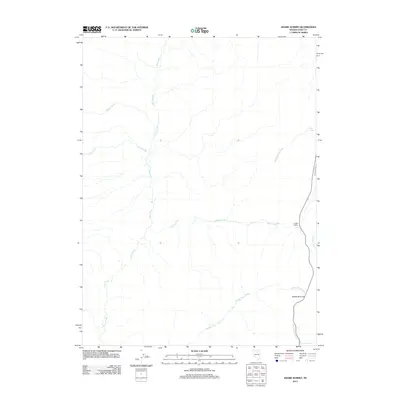
2012 Map of Adobe Summit
USGS Topo · Published 2012About this map
Adobe Summit serves as the focal point for this section of Elko County, where high-desert drainage patterns define the local geography. The landscape is dominated by the complex network of Susie Creek and its major tributaries, including Middle Susie Creek and Camp Creek, which carve through the terrain. Human activity is sparse but notable at the Adobe Ranch, which sits near the junction of several seasonal watercourses. The eastern edge of the quadrangle follows the path of Adobe Creek and East Adobe Creek, revealing how modern transport routes like Huney Do Rd still follow the natural contours of the basin. Scattered water sources such as Barrel Springs and Mud Spring indicate the critical role of hydrology in this high-altitude cattle ranching and range land.
Find a feature on this map
12 named features on this map. Tap any name to fly to it.
Don’t see what you’re looking for? This feature index may not catch every label — zoom into the map to look around manually.
Map Details
Editions of this 2012 Adobe Summit Map
This is the sole edition of this map. No revisions or reprints were ever made.
Other maps of this area

1955 · McDermitt
USGS Topo · 1:250,000

1955 · Wells
USGS Topo · 1:250,000

1955 · Winnemucca
USGS Topo · 1:250,000

1955 · Elko
USGS Topo · 1:250,000

1957 · Elko West
USGS Topo · 1:24,000

1958 · Winnemucca
USGS Topo · 1:250,000

1958 · Wells
USGS Topo · 1:250,000

1958 · Elko
USGS Topo · 1:250,000

1958 · Singletree Creek
USGS Topo · 1:24,000

1958 · Hunter
USGS Topo · 1:24,000