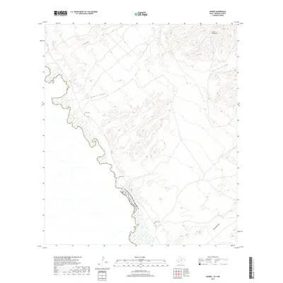
2019 Map of Adobes
USGS Topo · Published 2019About this map
The Rio Grande serves as the winding international border between the United States and Mexico in this arid Presidio County landscape. To the northeast, the foothills of the Chinati Mountains give way to a network of drainage systems including Arroyo Cienega and San Antonio Canyon. This region is defined by its isolation and the critical presence of water sources like San Jose Spring.
Find a feature on this map
13 named features on this map. Tap any name to fly to it.
Don’t see what you’re looking for? This feature index may not catch every label — zoom into the map to look around manually.
Map Details
Editions of this 2019 Adobes Map
This is the sole edition of this map. No revisions or reprints were ever made.
Other maps of this area

1896 · Ruidosa
USGS Topo · 1:125,000

1896 · Shafter
USGS Topo · 1:125,000

1959 · Presidio
USGS Topo · 1:250,000

1965 · Presidio
USGS Topo · 1:250,000

1966 · Adobes
USGS Topo · 1:24,000

1978 · Sierra Parda
USGS Topo · 1:24,000
1979 · Indio
USGS Topo · 1:24,000
1979 · Chinati Peak
USGS Topo · 1:24,000

1980 · Arroyo Melado
USGS Topo · 1:24,000
1980 · Las Conchas
USGS Topo · 1:24,000