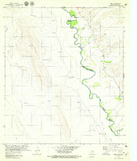
1979 Map of Indio
USGS Topo · Published 1979About this map
The Rio Grande Rio Bravo carves a winding path through this 1979 borderland survey, marking the international boundary between Chihuahua and Presidio County. Small riverside settlements like Indio and Buenavista are clustered near the river’s edge, where the terrain transitions from the steep ridges of Cerro Alto and C. La Abra Colorado to the fertile banks of the Rio Grande. Further south, the Canal Principal Margen Izquierdo illustrates the essential role of water management in this arid environment, supporting local agricultural efforts at El Paradero.
Find a feature on this map
27 named features on this map. Tap any name to fly to it.
Don’t see what you’re looking for? This feature index may not catch every label — zoom into the map to look around manually.
Map Details
Editions of this 1979 Indio Map
This is the sole edition of this map. No revisions or reprints were ever made.
Other maps of this area

1896 · Ruidosa
USGS Topo · 1:125,000

1896 · Shafter
USGS Topo · 1:125,000

1959 · Presidio
USGS Topo · 1:250,000

1965 · Presidio
USGS Topo · 1:250,000

1966 · Adobes
USGS Topo · 1:24,000
1979 · Presidio West
USGS Topo · 1:24,000

1980 · Arroyo Melado
USGS Topo · 1:24,000
1985 · Presidio
USGS Topo · 1:100,000
1993 · Presidio
USGS Topo · 1:100,000
2010 · Cerro Orona
USGS Topo · 1:24,000