
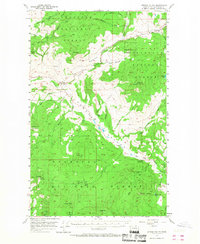
1957 Map of Aeneas Valley
USGS Topo · Published 1959About this map
Okanogan National Forest covers much of this high-elevation terrain, where the upper Sanpoil River and numerous mountain creeks carve out a complex network of ridges and flats. In the late 1950s, the Aeneas Valley remained a landscape defined by forestry and small-scale community life, centered around the Wauconda settlement and the Sunny Slope Grange Hall. The geography is characterized by distinct peaks like Bannon Mtn and Tunk Mtn, interspersed with mountain waters such as Gooseberry Lake and Lyman Lake.
Find a feature on this map
46 named features on this map. Tap any name to fly to it.
Don’t see what you’re looking for? This feature index may not catch every label — zoom into the map to look around manually.
Map Details
Editions of this 1957 Aeneas Valley Map
3 editions found
Other maps of this area

1902 · Osoyoos
USGS Topo · 1:125,000

1904 · Osoyoos
USGS Topo · 1:125,000

1904 · Republic
USGS Topo · 1:125,000

1951 · Wauconda
USGS Topo · 1:62,500

1951 · Bodie Mountain
USGS Topo · 1:62,500

1952 · Disautel
USGS Topo · 1:62,500

1953 · Bald Knob
USGS Topo · 1:62,500

1953 · Omak Lake
USGS Topo · 1:62,500

1954 · Okanogan
USGS Topo · 1:250,000

1957 · Mt. Bonaparte
USGS Topo · 1:62,500