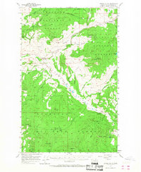
1957 Map of Aeneas Valley
USGS Topo · Published 1968About this map
Wauconda sits at the northern edge of this high-country landscape, where the Okanogan National Forest covers much of the terrain during the late 1950s. The area is defined by a series of prominent peaks and ridges, including Tunk Mtn and Aeneas Mtn, which overlook deep valleys and isolated springs like Aeneas Spring. Human presence is concentrated around specific community hubs and forestry outposts, notably the Sunny Slope Grange Hall along Bonaparte Creek and the Aeneas Guard Sta near the West Fork Sanpoil River.
Find a feature on this map
50 named features on this map. Tap any name to fly to it.
Don’t see what you’re looking for? This feature index may not catch every label — zoom into the map to look around manually.
Map Details
Editions of this 1957 Aeneas Valley Map
3 editions found

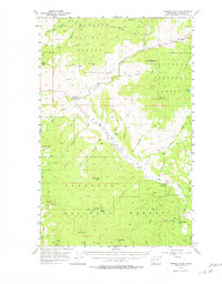
Other maps of this area

1902 · Osoyoos
USGS Topo · 1:125,000

1904 · Osoyoos
USGS Topo · 1:125,000

1904 · Republic
USGS Topo · 1:125,000

1951 · Wauconda
USGS Topo · 1:62,500

1951 · Bodie Mountain
USGS Topo · 1:62,500

1952 · Disautel
USGS Topo · 1:62,500

1953 · Bald Knob
USGS Topo · 1:62,500

1953 · Omak Lake
USGS Topo · 1:62,500

1954 · Okanogan
USGS Topo · 1:250,000

1957 · Mt. Bonaparte
USGS Topo · 1:62,500