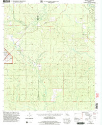
2003 Map of Afeman
USGS Topo · Published 2005About this map
The parish line between Vernon Parish and Rapides Parish bisects this pocket of central Louisiana, where the landscape is defined by the dense hydrological network of the Kisatchie National Forest. A collection of rural congregations and family burial grounds provides a clear genealogical record of the region's inhabitants, including Lone Star Ch, Mt Moriah Ch, and the Upper Mt Moriah Cem. While the settlement at Afeman sits near the headwaters of Hathaway Branch, the surrounding woods are etched with numerous drainages like Pilgrim Branch and Tenmile Creek. The western edge of the map shows the boundary of the Fort Polk Military Reservation, contrasting the area's spiritual and agricultural landmarks with the presence of federal military land and industrial activity at a local Gravel Pit.
Find a feature on this map
29 named features on this map. Tap any name to fly to it.
Don’t see what you’re looking for? This feature index may not catch every label — zoom into the map to look around manually.
Map Details
Editions of this 2003 Afeman Map
This is the sole edition of this map. No revisions or reprints were ever made.
Other maps of this area

1935 · Pawnee
USGS Topo · 1:31,680

1942 · Oakdale
USGS Topo · 1:62,500

1943 · Leander
USGS Topo · 1:62,500

1947 · Steep Gully
USGS Topo · 1:31,680

1947 · Pitkin
USGS Topo · 1:31,680
1951 · Pitkin
USGS Topo · 1:24,000

1951 · Steep Gully
USGS Topo · 1:24,000

1952 · Lake Charles
USGS Topo · 1:250,000

1953 · Alexandria
USGS Topo · 1:250,000
1954 · Pawnee
USGS Topo · 1:31,680