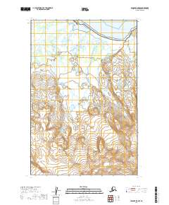
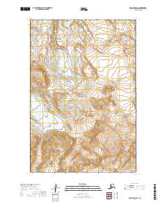
2019 Map of Afognak D-5 NW
USGS Topo · Published 2019About this map
Katmai National Park encompasses the majority of this coastal landscape, where the braided channels of the Douglas River flow northward into the cold waters of Kamishak Bay. The geography is defined by the slow movement of the Spotswood Glacier in the southwestern interior, illustrating the dynamic glacial processes that continue to shape the Kenai Peninsula's western reaches. This 2019 survey documents a wilderness largely devoid of modern infrastructure, focusing instead on the intersection of maritime shorelines and high-altitude ice fields. The map provides a precise record of township boundaries, including t14s r26w and t15s r26w, which segment the vast protected parklands and glaciated terrain.
Find a feature on this map
9 named features on this map. Tap any name to fly to it.
Don’t see what you’re looking for? This feature index may not catch every label — zoom into the map to look around manually.
Map Details
Editions of this 2019 Afognak D-5 NW Map
This is the sole edition of this map. No revisions or reprints were ever made.
Other maps of this area

1951 · Iliamna A-1 and A-2
USGS Topo · 1:63,360

1951 · Afognak D-5
USGS Topo · 1:63,360

1951 · Afognak D-6
USGS Topo · 1:63,360

1952 · Iliamna
USGS Topo · 1:250,000

1952 · Afognak
USGS Topo · 1:250,000

1957 · Iliamna
USGS Topo · 1:250,000
1983 · Afognak D-6
USGS Topo · 1:63,360
2018 · Iliamna A-2 SE
USGS Topo · 1:25,000
2018 · Iliamna A-2 SW
USGS Topo · 1:25,000
2019 · Afognak D-6 SE
USGS Topo · 1:25,000