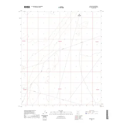
2023 Map of Afton NW
USGS Topo · Published 2023About this map
Las Cruces boundary lines extend into this arid landscape in the Mesilla Valley region, defining a space where the city's outskirts meet the desert floor. The terrain is largely characterized by subtle elevation changes and the organized grid of the Public Land Survey System, including t24s r1w and t25s r1w. Connectivity across this open country is maintained through a network of county routes, most notably Co Rd B006 and Co Rd B008, which strike linear paths across the section lines. Toward the southwest corner, the proximity to former rail-stop settlements is suggested by the presence of Afton Rd. This map captures a modern snapshot of the Chihuahuan Desert landscape as it transitions from the municipality of Las Cruces into the managed public lands of the Organ Mountains-Desert Peaks area.
Find a feature on this map
10 named features on this map. Tap any name to fly to it.
Don’t see what you’re looking for? This feature index may not catch every label — zoom into the map to look around manually.
Map Details
Editions of this 2023 Afton NW Map
This is the sole edition of this map. No revisions or reprints were ever made.
Other maps of this area

1891 · Las Cruces
USGS Topo · 1:125,000

1893 · Las Cruces
USGS Topo · 1:125,000

1941 · Las Cruces
USGS Topo · 1:62,500

1941 · Aden
USGS Topo · 1:62,500

1943 · Aden
USGS Topo · 1:62,500

1943 · Corralitos Ranch
USGS Topo · 1:62,500

1943 · Afton
USGS Topo · 1:62,500

1943 · Las Cruces
USGS Topo · 1:62,500

1955 · Las Cruces
USGS Topo · 1:250,000

1958 · Las Cruces
USGS Topo · 1:250,000