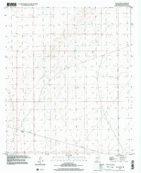
1996 Map of Afton NW
USGS Topo · Published 2001About this map
Arid basin landscapes and survey lines define this portion of Doña Ana, New Mexico, as recorded in 1996. The topography is dominated by the New Mexico Principal Meridian, a critical baseline for southwestern land division and property records. This survey captures a terrain largely devoid of modern development, instead showing the functional industrial infrastructure of the late twentieth century through multiple Pipelines crossing the southern sections. The map serves as a precise record of the desert floor's natural contouring before later potential shifts in resource extraction or utility expansion. It provides researchers with a clear view of how land was partitioned and managed in this expansive corridor of the Chihuahuan Desert.
Find a feature on this map
2 named features on this map. Tap any name to fly to it.
Don’t see what you’re looking for? This feature index may not catch every label — zoom into the map to look around manually.
Map Details
Editions of this 1996 Afton NW Map
This is the sole edition of this map. No revisions or reprints were ever made.
Other maps of this area

1891 · Las Cruces
USGS Topo · 1:125,000

1893 · Las Cruces
USGS Topo · 1:125,000

1941 · Las Cruces
USGS Topo · 1:62,500

1941 · Aden
USGS Topo · 1:62,500

1943 · Aden
USGS Topo · 1:62,500

1943 · Corralitos Ranch
USGS Topo · 1:62,500

1943 · Afton
USGS Topo · 1:62,500

1943 · Las Cruces
USGS Topo · 1:62,500

1955 · Las Cruces
USGS Topo · 1:250,000

1958 · Las Cruces
USGS Topo · 1:250,000