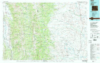
1982 Map of Afton
USGS Topo · Published 1982About this map
Star Valley serves as a primary corridor of settlement on this 1982 survey, where small communities like Afton and Grover are concentrated along the Salt River. The landscape transitions sharply into the high peaks of the Salt River Range and Wyoming Range, dominated by the Bridger National Forest. Historically significant transport routes are documented through the presence of the Lander Cutoff, a vital branch of the Oregon Trail system that traverses this mountainous terrain. The map also records the mid-20th-century industrial footprint in the area, noting extraction sites such as the Cottonwood Mine and Kleinstick Mine. To the east, the geography shifts toward the Green River basin, where Daniel and Marbleton mark the edge of the high desert plains, providing a comprehensive look at the intersection of alpine wilderness and agricultural valley life.
Find a feature on this map
118 named features on this map. Tap any name to fly to it.
Don’t see what you’re looking for? This feature index may not catch every label — zoom into the map to look around manually.
Map Details
Editions of this 1982 Afton Map
This is the sole edition of this map. No revisions or reprints were ever made.
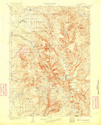
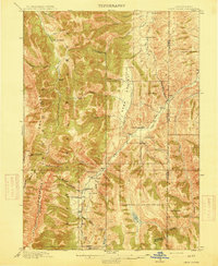
Other maps of this area

1907 · Gros Ventre
USGS Topo · 1:125,000
1909 · Fremont Peak
USGS Topo · 1:125,000

1909 · Montpelier
USGS Topo · 1:125,000

1910 · Gros Ventre
USGS Topo · 1:125,000

1911 · Montpelier
USGS Topo · 1:125,000

1915 · Freedom
USGS Topo · 1:62,500
1915 · Crow Creek
USGS Topo · 1:62,500

1921 · Afton
USGS Topo · 1:125,000

1931 · Jackson
USGS Topo · 1:125,000

1932 · Irwin
USGS Topo · 1:96,000