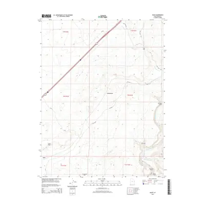
2014 Map of Agate
USGS Topo · Published 2014About this map
The Colorado River carves through the southeastern corner of this Grand County landscape, where it is joined by the Little Dolores River near Little Hole. This arid terrain is defined by its deep drainage systems and high plateaus, featuring prominent geologic landmarks like Westwater Canyon and Marble Canyon. The settlement of Cottonwood sits centrally amidst a network of washes, including Cottonwood Wash and Agate Wash.
Find a feature on this map
21 named features on this map. Tap any name to fly to it.
Don’t see what you’re looking for? This feature index may not catch every label — zoom into the map to look around manually.
Map Details
Editions of this 2014 Agate Map
This is the sole edition of this map. No revisions or reprints were ever made.
Other maps of this area

1885 · East Tavaputs
USGS Topo · 1:250,000

1885 · La Sal
USGS Topo · 1:250,000

1954 · Westwater 4 SW
USGS Topo · 1:24,000

1954 · Mt. Waas 1 NE
USGS Topo · 1:24,000

1954 · Mt. Waas 1 NW
USGS Topo · 1:24,000

1954 · Coates Creek
USGS Topo · 1:62,500

1956 · Westwater 4 SE
USGS Topo · 1:24,000

1956 · Moab
USGS Topo · 1:250,000

1956 · Grand Junction
USGS Topo · 1:250,000

1958 · Cisco
USGS Topo · 1:62,500