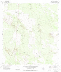
1972 Map of Agua Nueva
USGS Topo · Published 1975About this map
Agua Nueva and the surrounding rangeland of Jim Hogg County are characterized by an extensive network of windmills and family-named ranching landmarks. This South Texas landscape in the early 1970s reveals a pattern of dispersed settlement and resource management, with features like Palomas Ranch and several Gravel Pits dotting the terrain. The presence of the Ramirez Cem and a smaller Cem near the primary settlement provides valuable data for genealogists tracing regional family history.
Find a feature on this map
38 named features on this map. Tap any name to fly to it.
Don’t see what you’re looking for? This feature index may not catch every label — zoom into the map to look around manually.
Map Details
Editions of this 1972 Agua Nueva Map
2 editions found
Other maps of this area

1921 · Falfurrias
USGS Topo · 1:125,000

1938 · Agua Nueva
USGS Topo · 1:62,500

1939 · Encantada
USGS Topo · 1:62,500

1949 · Mc Allen
USGS Topo · 1:250,000

1954 · McAllen
USGS Topo · 1:250,000

1956 · Laredo
USGS Topo · 1:250,000

1957 · Mc Allen
USGS Topo · 1:250,000

1962 · McAllen
USGS Topo · 1:250,000

1968 · Palomas Ranch SW
USGS Topo · 1:24,000
1972 · Alta Vista Ranch SW
USGS Topo · 1:24,000