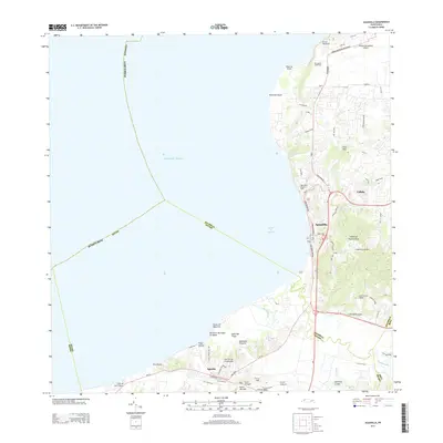
2013 Map of Aguadilla
USGS Topo · Published 2013About this map
Aguadilla and the neighboring settlement of Aguada dominate the western coastline of the Island of Puerto Rico in this 2013 survey. The landscape is defined by the sharp transition from the Atlantic Ocean and the sheltered Bahía de Aguadilla to the rising elevations of the Cordillera Jaicoa and Los Cerros Viñet. Transportation hubs like the Rafael Hernandez Airport near El Faro Borinquen contrast with the traditional agricultural and residential patterns of Cabán.
Find a feature on this map
59 named features on this map. Tap any name to fly to it.
Don’t see what you’re looking for? This feature index may not catch every label — zoom into the map to look around manually.
Map Details
Editions of this 2013 Aguadilla Map
This is the sole edition of this map. No revisions or reprints were ever made.
Other maps of this area

1937 · Aguadilla
USGS Topo · 1:20,000

1937 · Moca
USGS Topo · 1:20,000

1938 · Alto Sano
USGS Topo · 1:20,000

1941 · Moca
USGS Topo · 1:30,000

1941 · Rincon
USGS Topo · 1:30,000

1941 · Rincon
USGS Topo · 1:30,000

1941 · Isabela
USGS Topo · 1:30,000

1942 · Moca
USGS Topo · 1:30,000

1942 · Central La Plata
USGS Topo · 1:30,000

1942 · Aguadilla
USGS Topo · 1:30,000