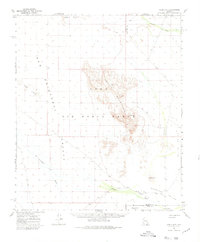
1965 Map of Aguila Mountains
USGS Topo · Published 1980About this map
The Aguila Mountains rise as a prominent central massif in this mid-1960s survey of the Sonoran Desert, which captures a vast expanse designated as the Luke Air Force Range. This arid landscape is defined by its drainage systems and desert valleys, including San Cristobal Valley and Childs Valley. The map records a sparse network of water sources critical for desert navigation, such as Natural Tank, Eagle Tank, and the seasonally variable Tenmile Wash.
Find a feature on this map
22 named features on this map. Tap any name to fly to it.
Don’t see what you’re looking for? This feature index may not catch every label — zoom into the map to look around manually.
Map Details
Editions of this 1965 Aguila Mountains Map
2 editions found
Other maps of this area

1927 · Aguila Mountains
USGS Topo · 1:48,000

1927 · Kim
USGS Topo · 1:62,500

1929 · Aztec
USGS Topo · 1:62,500

1930 · Aguila Mountains
USGS Topo · 1:62,500

1930 · Stoval
USGS Topo · 1:62,500

1931 · Kim
USGS Topo · 1:62,500

1949 · Sentinel
USGS Topo · 1:62,500

1950 · Sentinel
USGS Topo · 1:62,500

1950 · Stoval
USGS Topo · 1:62,500

1950 · Aztec
USGS Topo · 1:62,500