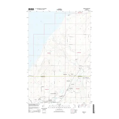
2014 Map of Ahmeek
USGS Topo · Published 2014About this map
Keweenaw National Historical Park anchors the southern portion of this Keweenaw Peninsula landscape, preserving the heritage of the copper mining era. The map details a dense corridor of settlements including Ahmeek, Allouez, and Centennial Heights, where the grid patterns of company towns are still clearly etched into the terrain. These communities are surrounded by a legacy of resource extraction and local industry, indicated by the network of local roads such as Sedar Hill Rd and Tamarack Waterworks Rd.
Find a feature on this map
71 named features on this map. Tap any name to fly to it.
Don’t see what you’re looking for? This feature index may not catch every label — zoom into the map to look around manually.
Map Details
Editions of this 2014 Ahmeek Map
This is the sole edition of this map. No revisions or reprints were ever made.
Other maps of this area

1915 · Houghton
USGS Topo · 1:62,500

1941 · Ahmeek
USGS Topo · 1:31,680

1941 · Mohawk
USGS Topo · 1:31,680

1946 · Phoenix
USGS Topo · 1:24,000

1946 · Hancock
USGS Topo · 1:24,000

1946 · Mohawk
USGS Topo · 1:24,000

1946 · Muggun Creek
USGS Topo · 1:24,000

1946 · Ahmeek
USGS Topo · 1:24,000

1946 · Laurium
USGS Topo · 1:24,000

1947 · Phoenix
USGS Topo · 1:24,000