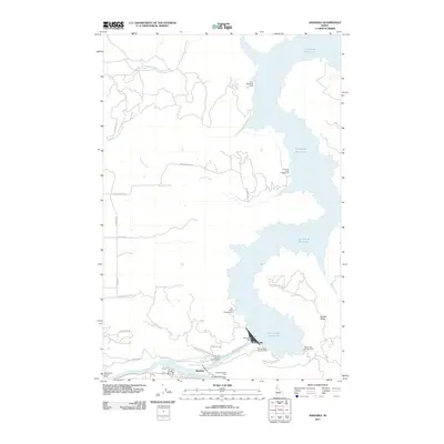
2011 Map of Ahsahka
USGS Topo · Published 2011About this map
Ahsahka sits at the significant confluence where the North Fork Clearwater River meets the Clearwater River, a landscape dominated by the massive engineering of the Dworshak Dam. This 2011 survey illustrates the complex relationship between the natural river systems and the expansive Dworshak Reservoir, which floods the canyons to the north. The presence of the Dworshak National Fish Hatchery and numerous riverside access points like the McGill Spur Access Area highlights the area's transition into a center for conservation and water-based recreation.
Find a feature on this map
30 named features on this map. Tap any name to fly to it.
Don’t see what you’re looking for? This feature index may not catch every label — zoom into the map to look around manually.
Map Details
Editions of this 2011 Ahsahka Map
This is the sole edition of this map. No revisions or reprints were ever made.
Other maps of this area

1924 · Kamiah
USGS Topo · 1:125,000

1955 · Pullman
USGS Topo · 1:250,000

1958 · Pullman
USGS Topo · 1:250,000

1961 · Ahsahka
USGS Topo · 1:62,500

1967 · Peck
USGS Topo · 1:24,000

1967 · Orofino West
USGS Topo · 1:24,000

1967 · Orofino East
USGS Topo · 1:24,000

1969 · Elk Creek Falls
USGS Topo · 1:24,000
1969 · Dent
USGS Topo · 1:24,000

1981 · Orofino
USGS Topo · 1:100,000